GETTIN’ OFF 4WD Off-Road Club – Oct 13 Meeting Minutes
Website: http://www.gettinoff4x4.com . We meet monthly, every 2nd Tuesday in the patio area at Antonella’s Ristorante, 1701 Park Avenue, San Jose , CA 95126 (408) 279-4922. Park on Naglee Ave or in the parking lot across from the restaurant. Meeting minutes are distributed a few days after each club meeting.
7:00 PM – BUFFET DINNER: Salad, Pasta, Pizza, Bread & Soft drinks($10). Attendees are encouraged to enjoy the buffet dinner or order from the menu to help Antonella’s recover the cost of using the patio area.
7:30 PM – Meeting starts NOTE: the actual meeting start is 7:30 PM (not 8PM as noted from the yahoo groups automatic reminder email).
WELCOME and BOARD REPORTS
President – Terry: Welcomed everyone.
Vice President – Brian: unable to attend.
Treasurer – Don: unable to attend
Secretary – Paul: No special news, but check “Saving Our Trails”, below.
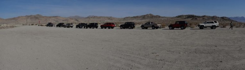
Members Attending – Chris W, Chris, Eric, Gary, Lyle, Mario, Michael, Paul E, Paul H, Randy, Roger, Ron, Steve, Terry
Brand New Members this month –
Guests Attending – 1, unnamed(?)
(If I missed anyone who attended please let me know.)
CLUB NEWS, ONGOING ACTIONS & IDEAS
1) Some of our Yahoo Groups recipients are not getting emails from the server (Chris W., Terry); Check your spam folders! Your secretary removed the emoticons in this issue to see if that helps.
2) Yahoo’s automatic meeting reminders – Need to change our meeting start time from 8 PM to 7:30 PM (7PM dinner).
3) Fire Permits are needed for any fire or stove use outside of improved campgrounds in National Forest or BLM areas. Obtain at http://www.preventwildfireca.org/Campfire-Permit/ and check local area rules too. .
VEHICLE PAINS & PROJECTS, STUFF FOR SALE
1) Chris W – Steering box causing frame cracks, welded in new crossbar & plate steel.
2) Randy – ‘Frankenstein’ Jeep almost ready
3) Steve – Suzuki painting nearly complete
4) Paul – To solve most starting & charging gremlins: “First replace the battery ! “. Don’t finesse it at first. Yup, that did it.
5) Lyle *Pain !* – Told horrific story about being T-boned on freeway while in F350 a few weeks ago by a drunk driver, with no insurance, and was charged with 4 other felonies(!) related to accident. Thankfully no major injuries, but some healing needed for all. All airbags deployed in Lyle’s F350, and all vehicles & trailer totaled (except 1 in trailer). Lyle says F350 design & safety systems saved them. Highway was closed for several hours. Was in Salinas (does alot of bad stuff seem to happen down there?).
RECENT RUNS & ‘CHANCES TO LOCK AXLES’
1) Sept 12 -13 – Twin Peaks & Ellis Lake+Peak trails. We’ll ran the Twin Peaks route near Sawmill Pond, and parts of the Tahoe side of the Rubicon on Saturday. 33″+ tires & 1 locker recommended. We arrived & stayed Friday & Saturday nights at Terry & Alane’s new place in South Tahoe off Hwy 89. Their house is very nice, in a neighborhood adjacent to national forest land. A big Thanks to Terry and Alane for inviting the group to stay a few nights. And there is a bear story too ! But it was not told.. yet…
Before lunch on on Saturday we went up Twin Peaks Road, which starts at Sawmill pond (copy & paste 38.888885, -120.025223 into Bing map’s search box) There are a few rock gardens on the way. (that have bypasses). At the top is a play area and views of the south Tahoe valley. We finished the trail and had lunch back at Sawmill Pond. the higher rock garden is pretty gnarly. No one went up it, a few went down it.
After lunch, we headed toward the Rubicon trailhead in Tahoma, and took the Ellis Lake/Peak Route located just a half mile in from the staging area. It’s a bumpy, rocky climb up, with a few tricky spots. We should have turned right at 39.057781, -120.200089 but we took the southerly fork to the left which eventually leads back towards the Rubicon. This fork route is not highlighted in the online maps but is clearly visible in the satellite views. (note on map apps: the new Bing maps app allows GPS tagging. Google allows tagging but road details are not as good as Bing. Yahoo Maps is now permanently off the air).
Photos & videos at: https://4door4x4.smugmug.com/Off-Road-Trips-1/Twin-Peaks-and-Ellis-Lake-Sept/n-x6ZFqh. To play a video, use the thumbnail view, and click on the “>” . The videos do not play in the slideshow mode.
2) Sept 18-19-20 Chris W. went the ‘Nocibur’ way into the Rubicon for the Marlin Crawler Round-up a few weeks ago. County workers were working on the V-Notch, but apparently the concrete bags they needed were run over & pushed down the hill by other wheelers, so work trail was suspended. Chris talked to Marlin, and said he’s the nicest guy you’ll ever meet. He went back out the Tahoe side due to traffic towards Loon Lake direction.
3) Chris – Niagara Rim – A few tough spots encountered. (sorry I did not get the details. Chris – feel free to chime-in).
4) Michael – Pinecrest Peak & Eagle Peak, up Hwy 108, off of Herring Creek Rd, ~10 miles past Strawberry. Pretty area up there and on Eagle Peak.
UPCOMING RUNS
1) October 24 – Sourgrass Adopt-A-Trail run. Hwy 4 Protocol (per the Adopt-A-Trail run) . Meet at ARCO off of Grant Line Rd Tracy 7:30, Burger King in Angels camp 9:15, Big independent gas station in Arnold at 10, or trailhead at 11 am. Bring lunch and tree trimming tools. Afterward, possible run to Slick Rock or ?
2) November 10- Club Meeting
3) November 14 – Barrett Lake Trail http://www.fs.usda.gov/detail/eldorado/news-events/?cid=STELPRD3847114. One day only, as camping at either lake could be pretty cold. Meet at the trailhead at Wright’s Lake at 9:30 am Saturday. We’ll run halfway in, until 2pm, and return back to Wrights Lake. 33s & rear locker minimum. I’m very interested in running this trail again and see what work was done over the past few years. It’s been some time since the last run. (better to run this trail in October for more daylight & outdoor temps if possible).
2) November 25-29 – Death Valley / Panamint. Eric suggested a few new areas to visit. About 4 rigs signed up so far. Not a hard-core rock crawl run, will be scenic, for exploring & history. Nevertheless, lockers recommended just in case it gets wet. (I think everyone has some kind of lockers now, right? Is anyone still “open-open”?)
3) December 12 – December Club Meeting, Toys for Tots & Christmas Dinner. Meet Saturday afternoon at Antonella’s at 3:30 PM, unless we decide to collect gifts at dinner, and someone to brings them to TFT the next day. If so, then arrive ~5pm; tbd.
8:30 PM – Meeting adjourned.
If there are any corrections, clarifications or updates, please chime-in. If you are an active member your name should be on this list:
Aaron, Alicia, Brad, Brian, Chris W, Chris ?, Dimas, Don, Eric, Gary, Genna, Jon, Joe, Lyle, Marco, Mario, Matt, Michael, Paul E, Paul H, Rahul, Randy, Roger, Ron, Steve, Terry, Tom K, Tom W.
Paul
————————————————————————
SAVING OUR TRAILS
Updates and New info in BOLD type. If you have new information feel free to send out an update. Though some are several months old, they are still active projects waiting for an outcome or completion.
1) California desert:
This is an important opportunity to contact the president & legislators about preserving multiple-use public access to areas in the California desert. CORVA, Cal4, BRC, and ARRA have sent out action alerts on this. Each has a slightly different take on the issue :
CORVA Background info & links: http://www.corva.org/email
CAL4 Background info: http://cal4wheel.com/access-issues/southern-california-access-issues/647-feinstein-to-host-public-meeting-on-proposed-desert-monument-designations
Action Link: http://cqrcengage.com/cal4wheel/app/onestep-write-a-letter?11&engagementId=136354
BRC- (BRC is using ARRA’s action alert page for this) Background info & link:
https://www.sharetrails.org/alerts/2015/10/08/urgent-letters-needed-oppose-going-forward-designation
You can create a brief or extended comment using the CORVA links, and/or read the talking points from the Cal4 & BRC/ARRA links which have other detailed information. Keep comments respectful & professional. I took the suggested text from Cal4 & BRC/ARRA, re-wrote the text in my own words, and sent comments using CORVA’s links. CORVA’s links are generic, direct to Pres. Obama, Sen. Mukowski, etc, whereas Cal4/ARRA copy & forward your text & basic personal info to the president & legislators. I also copied Dept. of Interior.
2) Jeff Blewett, Cal4 Wheel’s Natural Resource Consultant for No. Calif. just reported latest status these trails in the Fall issue of Cal4’s IN GEAR magazine:.
Deer/Clover Valley- Cal4: “late summer” ENF: “Fall 2016 or Summer 2016”
Pardoe’s/Squaw Ridge(‘Squaw’ renamed ‘Hungaleti Ridge Trail’) Cal4: “by the FS it is open”; ENF “mitigation work starts Fall 2016 or Summer 2016.
Strawberry Ridge- Cal4: “Summer 2016”; ENF “Summer 2017”
ENF’s overall route status is at : http://www.fs.usda.gov/detail/eldorado/home/?cid=fsbdev7_019037 . Finally a June 2015 update on the 42 Routes initially closed is at: http://www.fs.usda.gov/Internet/FSE_DOCUMENTS/stelprd3843438.pdf.
Many lessor-known routes are re-opened, but the best remain closed. Some of the route status in this update appear to be in conflict with Cal4’s assessments:
There are apparently no “public” links from the ENF Home webpage to the 42 Route Project web page, but it’s at: http://www.fs.usda.gov/detail/eldorado/home/?cid=stelprdb5362046
3) Carnegie State Vehicle Recreation Area near Livermore:
There have been attempts in the past to close it, but the riding public, CORVA, local Carnegie groups, and the Calif Dept of Parks-OHV Div have persisted to keep it open. A few years ago a new 4×4 obstacle course was created. Now, they plan to open up a new area, adding about 3000 acres with dozens of miles of new trails for motorcycles and 4x4s added to the existing 900 acres. CORVA created an entire web page for the expansion, which is chalk full of great resources and information: http://www.corva.org/Carnegie-SVRA-Expansion . It’s hard to know if this will be litigated, but it is moving that direction. In part these negative votes by Livermore & Alameda County were promulgated by the East Bay Regional Park District, who set up a false public expectation that this land could be acquired by them and converted to another regional (non-motorized) park. EPRPD has 120,000 park acres in Alameda & Contra Costa Cos, while Carnegie is the only motorized park in Alameda & Contra Costa Cos and is only 900 acres; (hopefully to be ~3900 acres). The SVRA owns the land, purchased by money from the OHV Trust fund, which comes from a tiny fraction of gasoline taxes and green sticker fees.
4) Know your Anti-Access Organizations – a sampler:
CSNC is the group that sued Eldorado National Forest and successfully convinced a judge to force ENF to close and/or repair trails. One of CSNC’s primary goals is to limit OHV. Website http://www.sierranevadaconservation.org/achievements/. While we generally have no issue repairing or re-routing routes around what have recently been identified as ‘sensitive’ areas, there was no need to close the entire lengths of all 42 routes for 2, 3 years or more. Many have re-opened, but many still remain closed to public access until only small sections are repaired.
CBD is one of the most notorious and powerful anti-access organizations. They often tend to lump motorized recreation access in with all forms of habitat interference, even though 99% of OHV use causes very little or virtually zero affect on animal habitat & popluation. Sample: “… cumulative threats from our changing climate, predation, drought, disease, and off-road recreation; and other threats all support an endangered listing….” re: http://www.biologicaldiversity.org/species/birds/Gunnison_sage_grouse/pdfs/Gunnison_sage_grouse_NOI.pdf and http://www.biologicaldiversity.org/programs/public_lands/off-road_vehicles/index.html. It’s very interesting they almost never mention other causes of habitat interferences such as: hiking, backpacking, mountain biking, camping, hunting, wildfires, highways, fences, etc. But apparently off-road recreation is “equal” with climate change, predation, drought & disease! CBD are also well known for launching a plethora of lawsuits, using the “Sue & Settle” tactic, thus taking millions of taxpayer dollars from the Forest Service & BLM to pay their attorneys: http://naturalresources.house.gov/news/documentsingle.aspx?DocumentID=301242 and http://www.biologicaldiversity.org/about/staff/
PEER (Public Employees for Environmental Responsibility) http://www.peer.org/campaigns/public-lands/off-road-wreckreation/news-releases.html and http://www.peer.org/news/news-releases/2013/01/07/court-orders-tighter-off-road-plan-for-stanislaus-forest/
Older Actions
1) Plumas National Forest lawsuit. (for details see previous Saving Our Trails and go to Corva.org) https://www.youtube.com/watch?v=8jN3Xdy0CKM&feature=youtu.be and http://www.corva.org/FS.Lawsuit
2) Deer Valley Route closures from Jan to July 31 due to Yosemite Toad (see previous Saving Our Trails and latest Eldorado 42 Routes closure news above) http://cal4wheel.com/access-issues/northern-california-access-issues/541-forest-service-proposing-seasonal-closure-on-deer-valley-trail & http://www.pirate4x4.com/forum/land-use-issues/1909145-forest-service-proposing-seasonal-closure-deer-valley-trail-yosemite-toad.html
———
Let Amazon.com contribute a 0.5% of your purchases to BRC. The Blue Ribbon Coalition, a 501(c)(3) organization. It costs virtually zero $. How do you sign up? 1) Sign-in to your Amazon account. 2) On another tab/window, Go to http://www.sharetrails.org/content/support-brc-while-shopping-online to read how it works. 3) Click on http://smile.amazon.com/, and you will see info and a short list of charities. For BRC, type in “BlueRibbon Coalition” exactly as shown here, in the search box. The result should be “Blueribbon Coalition Inc” and “Categories: Natural Resource Conservation and Protection” and “Location: Pocatello, ID”. (Be careful–there are dozens of other ‘Blue Ribbon xxxx’ charities out there, be sure you have the right one.) 4) Click OK to sign-up, and BRC will receive 0.5% of your purchase amounts at no cost to you. To automatically donate, shop only at the “Smile” web address: https://smile.amazon.com/ (if you use Amazon’s normal web address, no donations are made). You can change charities or cancel anytime.
———
There are dozens of other, mostly irrational public land & road closures in the works by the enviro-left/elite, so we encourage everyone to check Blue Ribbon Coalition, Cal4wheel, Corva.org, and Pirate4x4 websites for the latest access news, and contact land managers and government officials and tell them public land is for everyone.